Flamborough Head is a promontory, 8 miles (13 km) long on the Yorkshire coast of England, between the Filey and Bridlington Bays of the North Sea. It is a chalk headland, with sheer white cliffs. The cliffs on the north side of the headland provide nesting sites for hundreds of thousands of seabirds including Guillemots, Razorbills, Puffins, Gannets and Kittiwakes. They are also of international significance for their geology.
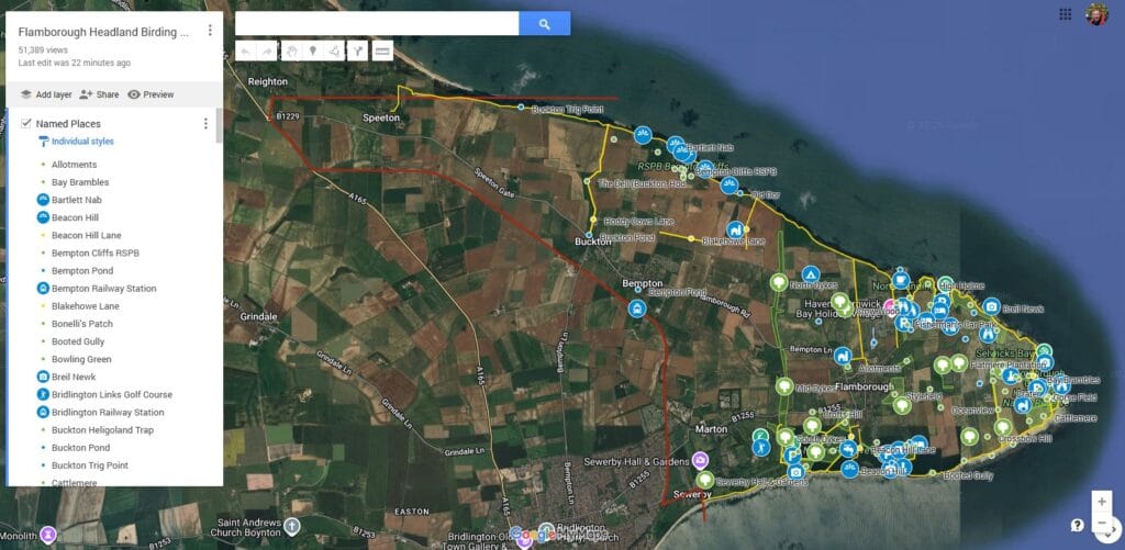
Flamborough Bird Observatory maintains records and operates ringing stations for the whole Flamborough Headland including the Bempton Cliffs RSPB reserve indicated on the map below. The Flamborough Headland Recording Area is broadly the same as the Flamborough Headland Heritage Coast and encompasses the whole area to the east of Danes Dyke including the village of Flamborough and also, to the west of the dyke, the areas surrounding the villages of Bempton, Buckton and Speeton on the north side of the headland and as far west as Sewerby Steps and the parkland of Sewerby Hall on the south side. Records for this whole area are published in our annual reports and daily blogs. Please contribute your counts and photos or records of scarce and rare birds by sending them to fborecords@hotmail.com